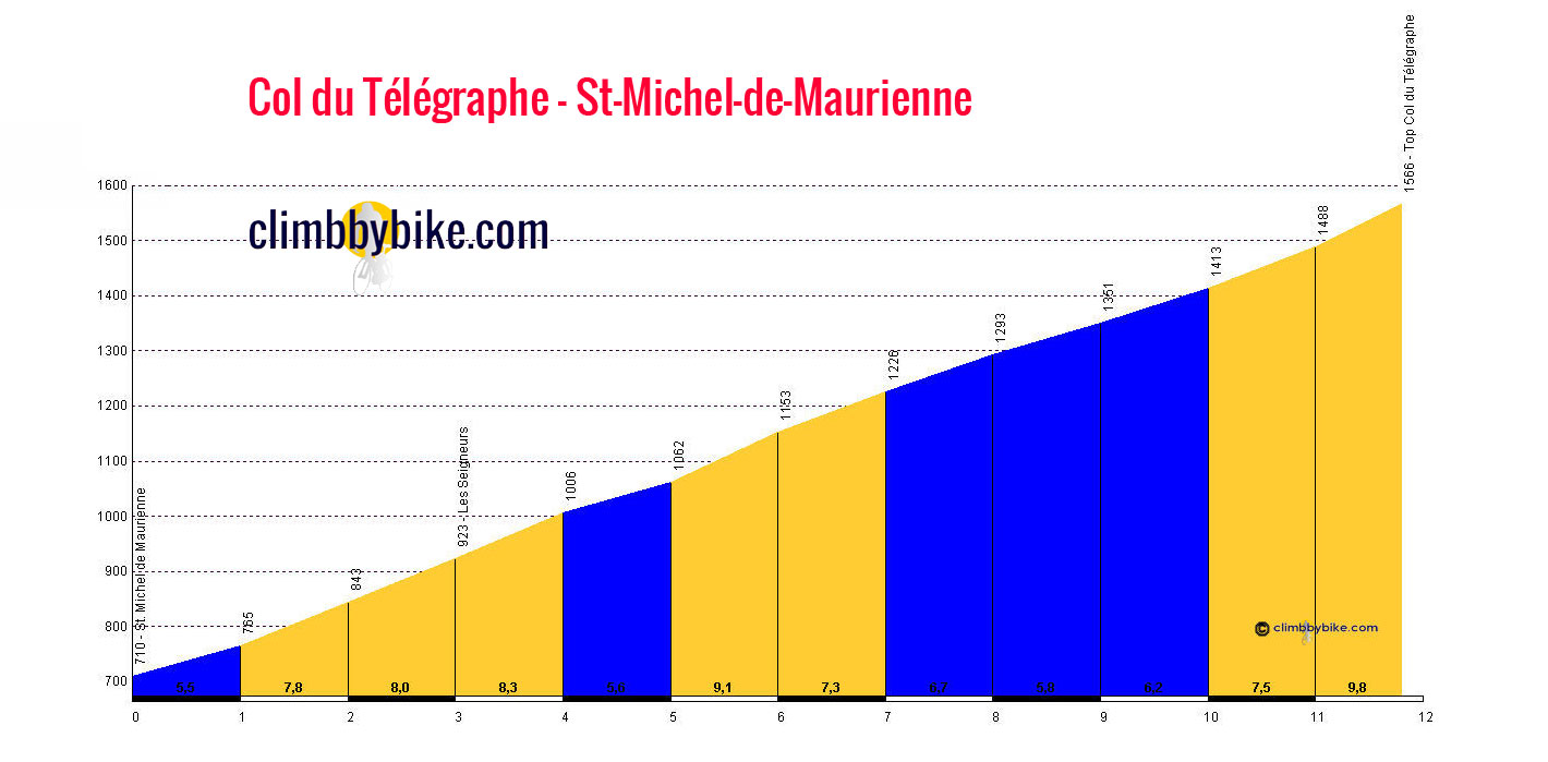
Col du Télégraphe from St Michel Maurienne in the Savoie
Col du Télégraphe is in the Savoie area of the Alps at an altitude of 1566m, and connects St Michel Maurienne with the ski resort of Valloire.
The road starts rising steeply immediately upon crossing the bridge leaving the village; as the gradient increases with every hairpin, you are rewarded with better and better views of the mountains!
The climb is steady, though some of the hairpins are steep, and the climb ramps up for the final push to the top.
The col has been crossed by the Tour de France 29 times since 1947, though often as part of the descent from the Col du Galibier; consequently it has only been ranked for points 18 times.
Length: 11.8km
Height at start: 710m
Height at finish: 1566m
Average gradient: 7.3%
Maximum gradient: 11%


