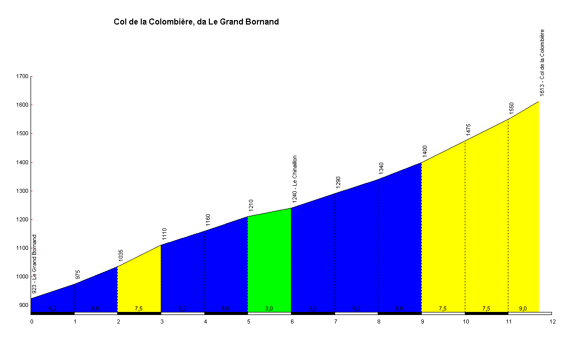
Col de la Colombière from Le Grand Bornand in the Haute Savoie
Col de la Colombière, at an altitude of 1613m, is in the Aravis region of the Northern Alps. It links the towns of Cluses and Bonneville to the north-east with the villages of Le Grand Bornand and La Clusaz to the south-west.
The climb to the col from the village of Le Grand Bornand is shorter and less steep than when tackled from the other side, but at 11.7km in length and with an average gradient of 5.9% it represents a decent climbing challenge, particularly the last 4km beyond the ski village of Le Chinaillon.
The Tour de France has climbed the col from this side 14 times in its history, and does so again in 2016 on its way to a finish in Morzine via Col de la Ramaz and Col de Joux Plane.
Length: 11.7km
Height at start: 923m
Height at finish: 1613m
Average gradient: 5.9%
Maximum gradient: 9%


