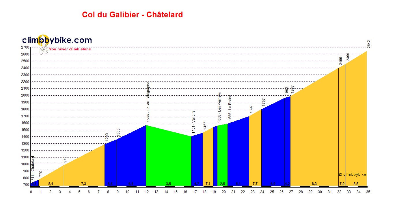
Col du Galibier from St Michel de Maurienne in the Savoie
Col du Galibier is at an altitude of 2642 and is in the Savoie area of the Alps. The Galibier is accessed by either the Col du Telegraphe or the Col du Lautaret.
From this side, you first ride up the Telegraphe, in itself a challenging 12km climb through forested switchbacks. After a gentle 4km descent in to the ski resort of Valloire, the road pitches up briefly before a gentle climb alongside the Valloirette river.
The climbing in earnest begins after the Plan Achat restaurant, rarely dropping below 8% after passing the 2000m mark with a very punchy last couple of kilometres before arriving at the summit.
The col has been crossed by the Tour de France no fewer than 31 times and has been ranked as HC (hors categorie) every year since 1979. To mark the 100th edition of the col in the Tour de France, the col was crossed twice in 2011.
Length: 34.9km
Height at start: 718m
Height at finish: 2642m
Average gradient: 5.5%
Maximum gradient: 12%


